
- 9691858058, 6264506023
- bhoojalsurvey@gmail.com
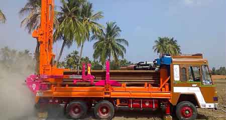
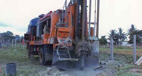
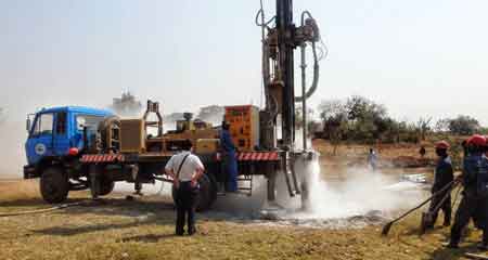
Borewell Drilling
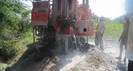
Bhoojal Borewell is recognized as one of the leading and reliable drilling contractors for extracting groundwater in INDIA (Andhra Pradesh, Kerala, Maharashtra, Madhya Pradesh, Orissa, Rajasthan and Tamil Nadu). Working from recent decades in this business, the company excels in providing solutions for all kinds of groundwater related problems. Our Drilling administrators and specialized staff are vital piece of the organization having a tremendous involvement in borewell, tubewell and water well drilling works. Holding latest machinery and equipment’s we have successfully completed many borewell and water well drilling operations around the country.
We can solve groundwater problems for Domestic purposes as well as Commercial / Industrial purposes. We undertake drilling and installation work of 8", 7½", 7", 6 ½" and 4½" diameter bore wells up to a depth of 1800 ft. for sites, residence, apartments, institutions, industries and agriculture sector etc. We can help farmers in construction, protection, maintenance and treatment of a water well for drinking and irrigation purposes.
Our services
- Borewell Drilling
- Rebore / bore flushing
- Reports estimating well yield
- Taking permissions for borewell, water well drilling operations from government authorities
- Guaranteed yield borewell drilling (includes surveying the area for water potential)
- Pumps, motors and control panel for extracting ground water.
- Feasibility Survey for water well drilling.
- 4 1/2", 6", 8", 10", 12" inches dia bore well drilling.
- Earth work for all type of drilling will be done [Blast Hole Drilling, Cable flowing, Core Drilling, Telescopic Drilling, Drilling in Coal Mine, Drilling in Gold Mines, Earthing-Holes]
- Development of contour maps
- Construction of tubewells, assembly design , selection of pumps & installation in most scientific manner.
- Maps and profiles showing groundwater (aquifer) depth, thickness, and quality to plan new well sites.