
- 9691858058, 6264506023
- bhoojalsurvey@gmail.com
Ground Water Survey
At Bhoojal survey and recharging we explore ground water by Conducting Hydrogeological , Geophysical (Vertical Electrical Soundings) and GIS Survey's at different locations within the Project Area for identifying groundwater potential zone for optimal water yield.
Accompanied by latest equipment's and software's we aim at pin-pointing prime underground water location with utmost precision.
A well-designed, expertly-interpreted geophysics survey from us can help you answer both questions:
What is the depth to aquifers ? and
Where is the best place to drill a borewell ?
What is Ground Water ?
Groundwater is the water present beneath Earth's surface in the splits and spaces in soil, sand and crevices in rock. Groundwater originates from rain and from melting snow and ice and moves gradually through geologic arrangements of soil, sand and shakes called aquifers.
Why to go for a Ground water Survey before drilling ?
Once the depth to the water table is known for an area, drilling to that depth from almost any location in the target area might encounter some amount of groundwater. Although Drilling to obtain underground water with no prior investigations can quickly become a potential threat for a project in case drill location is not a self-recharge zone or produces a low yield.
In the event that the water prerequisites are not met from groundwater as a result of low yield and non-accessibility of other water resources a second drilling becomes a necessity and a costly affair.
Geophysical survey of site before drilling can resolve such dreadful issues and assure water demands before in hand. We excel in finding the quality and quantity of groundwater necessary for development while making the best use of investment.
Who should look for us -:
Groundwater survey will benefit home owners whose borewells have gone dry or flow has decreased, land owners who need a borewell site located for new construction, infrastructure developers building outside of city water service areas, property owners wishing to provide a borewell location guarantee to buyers, farmers who need irrigation borewells, utility companies exploring new borewell sites and water development strategies, geophysical survey can be conducted for engineering firms planning or aiding in new construction or development, and anyone that desires professional insight into their borewell water needs or borewell problems before drilling.
Survey method -:
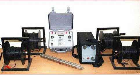
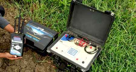
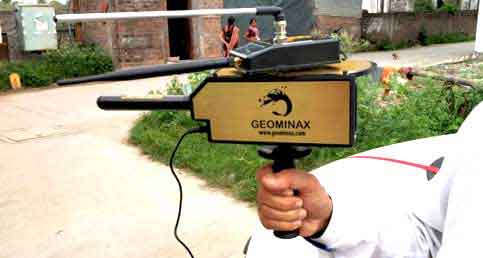
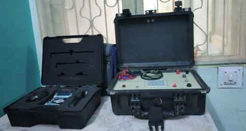
Resistivity Sounding using MPSSR-ATS Instrument with Schlumberger and Wenner electrode configuration & Interpretations of underground lithology using IPI2WIN , Hydro geo analyst Visual Mode flow Flex.
In Layman's terms -:
- Groundwater Survey instrument helps us to detect underground water.
- Underground strata, logs are generated from data obtained by using instrument.
- Suitable drilling site is determined by analysing details
- Reports and Design are prepared for better understanding.
We have successfully located tens of thousands of potential water locations for our clients.