
- 9691858058, 6264506023
- bhoojalsurvey@gmail.com
Computer Modelling
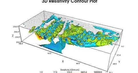
Over the past 30 to 40 years, developments in computer technology, computer programs, and databases have significantly increased the use of computer modeling in water resources planning and management. Computer modeling and analysis of water resources systems have become an increasingly important aspect of our work in water resources development, permitting, aquifer test analysis and environmental applications. Bhoojal Survey computer modelling expertise encompasses numerical and analytical groundwater flow modelling, aquifer test analysis and contaminant mass transport. We are familiar with the latest versions of the published models and pre-processors accepted by Central Ground water board .
The Firm has developed groundwater models for numerous projects. These projects range from local site-specific models of relatively small areas to models of regional and sub-regional hydrologic systems.
At Bhoojal Survey we have highly-experienced hydrologists and computer modelers who keeps on updating themselves with the latest regional groundwater flow models published by various government agencies. Having used these models many times for groundwater resource and 100-year impact evaluations, we are proficient at adapting these models to support the requirements of our client’s projects.
We know what it takes to conduct successful water resources system studies that meet clients’ objectives and information needs. In addition to possessing the requisite mathematical, statistical, and computer skills; Bhoojal Survey’s professionals have in-depth knowledge of local and regional hydrogeologic conditions, and years of experience working in this field. At bhoojal survey we also know the limitations of computer models – that models produce information, not decisions. A key aspect of bhoojal survey groundwater modelling expertise is our ability to understand and communicate the assumptions upon which a model is based so that the model results can be defended.
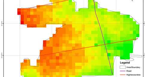
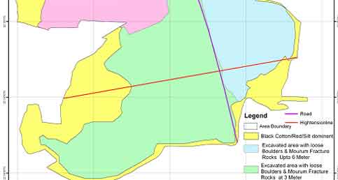
We have successfully located tens of thousands of potential water locations for our clients.